Guide Map & Locations
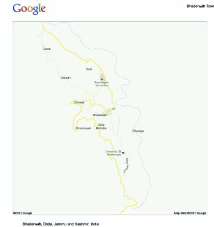
Geographical Coordinates: 32°58'48"N , 75°42'55"E
Bhaderwah is bounded on the north by Kishtwar on the east by Chamba, on the south by Balor or Basholi and on the west by Chenani. It is located at a distance of 206 Kms north-east of jammu, 90 Kms south of Kishtwar, 36 Kms east to Doda, 150 north west to of Chamba and 115 Kms north of Basholi. It is about 80 Kms from Batote situated J&K National Highway NH1A.
The Beautiful and enchanting valley of Bhaderwah town is situated in a very beautiful and cultivated . It is about half kilometers away from the left bank of Neeru nallah (Skt :Nira- Water). Bhaderwah is an elliptical valley with approx. 12 Km and 4 Km radii, major and minor respectively. The population of the town is about 12 thousand including those of peripheral villages.